A welcoming city has transportation choices

It doesn’t feel good when people in your city scream at you. Last month I was on my bike, on a downtown street, making my way to the new bike lanes a few blocks away. A truck driver yelled at the top of his lungs: USE THE F$&#ING BIKE LANES!!!

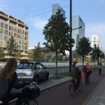
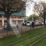
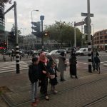
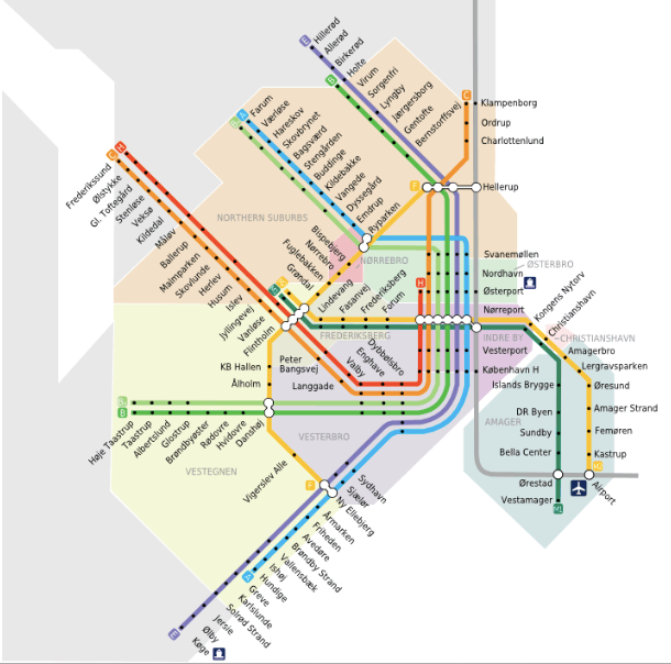
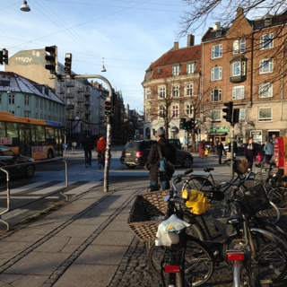
Only three days before this happened, I jumped on a bicycle, rode 15 minutes on streets of various sizes that accommodated many modes of transportation — bicycles, pedestrians, scooters, cars, trucks, buses and trams – to get to Utrecht’s Central Station in the Netherlands. I got on a train with my bicycle and in 30 minutes was emerging from Amsterdam’s Central Station with a map in my pocket and two hands on handlebars, to make my way on bustling unfamiliar medieval streets to Park Museumplein and the surrounding sights. I was in the busy throng of people moving in many ways through the city.

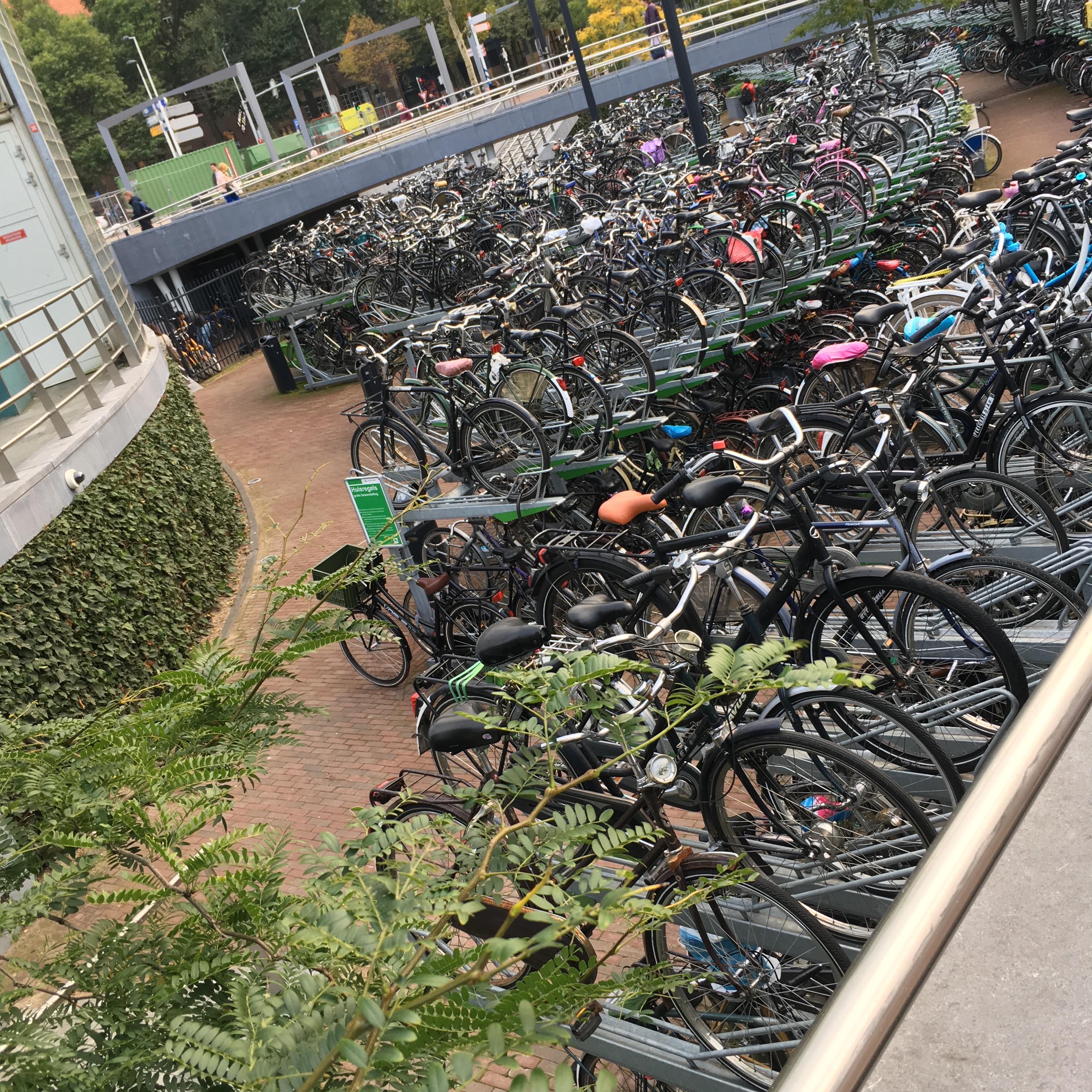
There were choices about how to move in Utrecht and Amsterdam. I could choose to move by car, on foot, on a bicycle powered by me or electricity or gas, or by bus, tram or train. The city is designed for choice and the inhabitants live the choices they have made available to themselves. There are people who choose cars. There are people who choose bicycles or scooters. There are people who choose buses, trams and trains. And there are people who choose it all. Most importantly, those choices are available just about everywhere. There is significant public investment made to do this, in the streets and even bicycle parking lots. (Check out this article about the Utrecht Central Station bicycle parking facilities for 22000 bicycles.)

The inhabitants live the choices they have made available to themselves.

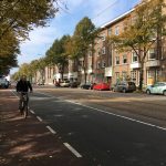
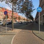
There are sensible separations that are responsive to scale and speed, always with a the larger intention to allow choice. There are no bicyles on highways, but bicyles can be on trains or you can ride your bike between cities. In the city proper, bicycles are everywhere and the city is made for it. Make a sidewalk a bit wider, paint it a different colour and there’s room for bicycles on a busy street of any size. On a small local street, bicycles are on the street with the cars. Intersections are made for all modes of transportation and while messy compared to the simplicity of an intersections only for cars, it works perfectly. All people, regardless of their chosen mode of transportation, exhibit care and look out for each other. That’s how it works: accommodation.

All people, regardless of their chosen mode of transportation, exhibit care and look out for each other. That’s how it works: accommodation.

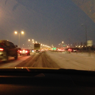
Back in Edmonton, in North America, my experience is a startling contrast. In one 20 minute ride into downtown and back home I realize:

  1. There is no place for me to be. I have to choose to be like a car and be on the road or choose to be like a pedestrian and be on the sidewalk. My ride starts on a quiet street so I choose the street. When the car traffic gets busier I ride on the sidewalk. I don’t like to do this.
  2. The new bicycle path does not go to where I am going, so I choose not to use it, despite wanting to support the public investment.
  3. Friendly drivers don’t know what do to. On a quiet street I choose to ride on the street. At an intersection where I have the stop sign, a driver stops and waves me on. This is nice, but she would not stop like this if I was a car.
  4. The streets with new bicycle lanes downtown do not go where I am going. As I travel through downtown, I pass cross streets with bicycle lanes. I could move south, away from where I am going, to be on a bicycle lane, but that is out of my way and doesn’t feel right. I stay on the street because there are few vehicles.
  5. There isn’t a place to park my bike. I arrive at my destination, Edmonton Tower, for a meeting with City of Edmonton colleagues. There is room for 12 bicycles to park and it is full. I ask, again, for the security personnel to pass along to the management that more facilities for bicycle parking are needed.

    Bicycle parking at Edmonton Tower is oversubscribed.
  6. Some drivers are ANGRY. On my way home, I decide to go out of my way to use one of the new bicycle lanes, so there is one more visible cyclist using this investment. On my way there I find myself on a narrow street with no sidewalk because of construction. This is when the driver screams out his window: USE THE F&%$ING BIKE LANE!!!! I was in the only place I could be to get to the bike lane.
  7. Another driver is ANGRY. A bit later, while crossing a street (on the street like a car) a driver honks his horn at me. I look (maybe it’s someone I know?) and see him moving his fingers as if I should be walking across the street. I shrug my shoulders. He honks again. Longer.

This is not the Edmonton I want to be, where the power of the car dominates the choices of its citizens. But lets be clear — we give the car its power. It is our choice. We attach ourselves to the car life and feel threatened by the choices that are available to all of us. The car brought us a sense of control, an ability to go where we want when we want. This is, however, a form of power over people who by choice or need do not use a car. More of us have control – in the form of choices – if more of us have choices about how to move around in our city.

To be friendly to all modes of transportation, this is what I envision for Edmonton:

  1. Various modes of transportation are available to all citizens. This means both physical access (is the infrastructure there) but also the financial means of the user. This takes place both on the street and also across the city. (Note – street here means the entire public right-of-way.)
  2. Various modes of transportation are available to all citizens EVERYWHERE. It isn’t about choosing specific places where bicycles and buses and trains will go. It’s about choosing specific places where bicycles will not go. Bicycle infrastructure is cheap and easy. Just do it. This takes place both on the street and also across the city.
  3. There are clear rules for how street users behave because there is a clear place for them. Pedestrians, cyclists and vehicle drivers all have their own place to be on the street and know what to expect of each other. The bicycle is not a pedestrian or a car or a train, but since we don’t have a place for bicycles, we have unnecessary conflict between street users.
  4. All street users are courteous and patient. It’s easy to navigate a street for cars or a street for pedestrians. It’s more complicated to navigate a street for cars and pedestrians. It’s more complicated to navigate a street with cars, pedestrians, bicycles, trams and scooters, but it is doable. Millions of humans live this in various parts of the world. The choice is ours, but it will take courage to behave in ways that are courteous and patient both as we recreate our city and figure out how to relate to each other and our city differently.

There is hard work ahead for us in North American cities. We have a built form that serves the car and we need to shift it to include other ways of moving. This is a gargantuan task, but is not the biggest task. The biggest task is to be civil and friendly with each other while doing the difficult work of making cities that serve citizens well.

Some of the bicycle parking at Rotterdam’s Blaak Station near Markthal.

The core of Nordic public transportation


Does density bring better public transportation, or does better public transportation bring density? This is the question I’m grappling with after beginning a series of posts reflecting on my family’s winter holiday – a tour of the capital cities of the Nordic nations at the heart of winter.

I first noticed how our modes of transportation were so different from our life in Edmonton, a city on the Canadian Prairies. The city planner in me needs to explore what is structurally, there and here. When I explored the population density of the cities we explored, I found that most Nordic cities were far more dense than the large cities on the Canadian Prairies (Calgary, Edmonton and Winnipeg). For example, Copenhagen is six times more dense than Edmonton.

density by mun boundary

In my last post, Nordic density, I noted the physical differences of these densities. In this post, I take a look at public transportation, but before I do, let’s take a quick look at the population density of the urban area for each of these city-regions. (I’m using Thomas Brinkoff”s calculations based on the agglomeration of an urban area – a central city and the neighbouring communities linked to it by continuous built up areas or commuters.) This is an vital way to look at density without the inaccuracies of vast tracts of land that are undeveloped in some municipalities, and not others.

The numbers below reflect the density of the actual built-up area, regardless of the location of the municipal boundary. This is the number that most reveals what’s happening on the ground.

density by agglomeration

On the ground, Reykjavik, Oslo and Stockholm are the most dense cities. Edmonton and Winnipeg are the least dense. The reason why they are less dense is the large area of developed land, with low population. The bar charts below are using numbers relating to the built area – not the municipal boundaries.

population by agglomeration

Area by mun boundary


Some Public Transportation Numbers

Not all of these cities provide LRT or Metro/Subway transportation to residents (Winnipeg and Reykjavik do not). The first to start was Oslo in 1898. Stockholm was next in 1950 (with “pre-metro) service in 1930. Edmonton, Calgary and Helsinki completed LRT / Metro service between 1978 and 1982. Copenhagen added its Metro line in 2002.

Stockholm has the most kilometres of track at 105.7km, followed by Oslo at 86km.

lrt-metro km of track
Does not include commuter trains

Stockholm also moves the most passengers per day, at 898,630 by rail.

lrt-metro # passengers daily
Does not include commuter trains

To compliment LRT/Metro service, Oslo, Stockholm and Helsinki also provide tram/trolley options for movement in the city. Oslo and Helsinki accommodate an additional 132,000 and 200,000 riders daily. (I am unable to locate ridership for Stockholm.)

Edmonton had 90 km of tram service from 1908 to 1951, and 127km of trolleybus service from 1938 to 2009. Calgary had trolleybus service from 1947-1975 and is looking at its streetcar history for future transit. Winnipeg had 193km of streetcar service from 1918 to 1955. These services have been replaced by bus.

Stockholm moves a great number of people by bus, as do Edmonton and Helsinki. I am unable to find bus ridership numbers for Reykjavik and Copenhagen, but it is clear that ridership for Stockholm is again high, at 814,000 passengers, in addition to high numbers of passengers my Metro, and tram/streetcar.  Edmonton and Helsinki have higher numbers of passengers moving by bus than LRT/Metro.

bus incomplete
Missing – numbers for Reykjavik and Copenhagen


The Mesh and the Linear Patterns

Stockholm is both the most densely populated city and the city with the largest investment in track and the largest ridership. Oslo also has a significant investment in the T-bane.

Stockholm T-Bana map
Stockholm’s T-bana
Oslo T-Bane
Oslo’s T-Bane

Copenhagen has the most the recent rail system, first complete in 2002, and they are now constructing The City Circle line (not shown), which will add an additional 15.5km of track to the 20.4km system. The current system below, is 20.4 km.

Copenhagen metro districts
Copenhagen’s Metro (M1 and M2 shown). The Circle Line (M3 and M4 under construction).

In contrast, Edmonton’s 21 km of track, barely more than Copenhagen’s track, serves the city in a radically different way. Instead of serving the population at the core (remember there are many more people in the core of Copenhagen), the Edmonton system serves the population along a length of track.

Edmonotn existing lrt
Edmonton’s LRT (4lrt.com)

Even with the planned construction out to 2040, Edmonton continues to serve a sparse population with a sparse LRT.

Edmonton LRT built out
Edmonton’s LRT build out 2040 (4lrt.com)

Helsinki has 21.1 km of track. It, too, stretches in linear fashion through the city.

Helsinki Metro line
Orange – Helsinki Metro (urbanrail.net)

Calgary’s CTrain, at 60 km, is still fairly linear in nature.

Calgary CTrain map

There are two patterns at work here, and they are connected to density. The mesh of Copenhagen, Oslo and Stockholm appear with higher population density. The linear pattern of Edmonton appears with low, sparse population.

Does density bring better public transportation, or does better public transportation bring density? 

_____

If you are interested in exploring the ground I’ve covered in reflecting on our visit to these winter cities in winter, here’s the thread of these Nordic posts:

  1. We chose to stay in nifty Nordic neighbourhoods
  2. Our Nordic modes of transportation were different than in Edmonton
  3. Nordic density is different from density in cities on the Canadian Prairies

_____

Sources:

Population, area and density:

  • Thomas Brinkhoff: City Population, http://www.citypopulation.de 

Transportation:

  • http://www.edmonton.ca/transportation/ets/about_ets/ets-statistics.aspx
  • http://www.edmonton.ca/transportation/2013_LRT_Passenger_Count_Report.pdf
  • https://www.calgarytransit.com/about-us/facts-and-figures/statistics
  • http://www.apta.com/resources/statistics/Documents/Ridership/2014-q1-ridership-APTA.pdf
  • http://www.lta.gov.sg/ltaacademy/doc/13Sep105-Pan_KeyTransportStatistics.pdf
  • https://www.hsl.fi/sites/default/files/uploads/hsl_moves_us_all_1.pdf
  • http://en.wikipedia.org/wiki/

Our Nordic modes of transportation


Our modes of transportation.png.001
Caveat – we did not travel by bicycle due to a broken arm in the family.

Last week I returned from my winter tour of the capital cities of the Nordic nations: Reykjavic, Iceland; Oslo, Norway; Copenhagen, Denmark; Stockholm, Sweden; and Helsinki, Finland. Over the next few weeks,  will be sorting and sifting through my thoughts about the trips, searching for better understanding of cities, both Nordic and those on the Canadian Prairies.

The first thing I noticed is that these Nordic Cities are not the same as my home city, Edmonton. The way we moved around was totally different.

We chose to stay in apartments in neighbourhoods in close proximity to the city center in each city. We were able to get groceries and all services within a couple minutes walk from each location. We were able to access public transportation in most cases right outside the building, or at most a 3 minute walk. We noticed each city had schools everywhere. We noticed streets that were alive with people and business. We noticed an explicit infrastructure for bicycles (and the bicycles!) on busy streets, along with cars and buses and trams and trolleys.

Copenhagen - multiple modes of transportation
Copenhagen, December 28, 2014

These city amenities are found in tiny pockets in Edmonton. They are are everywhere in these Nordic cities.

In contrast, our arrival was significant time in a car, stuck on a highway, then a freeway.

Back in Edmonton
Traffic no longer moving on the Anthony Henday, Edmonton, January 7, 2015

Over the next few posts, I will dig into two city patterns at work here: one that aims to serve the movement of cars, an other that aims to serve the movement of people. The cities were designed for different purposes.

The city planner in me needs to dig into what is different about there and here.

City By Design

Edmonton's children: Where they live, where they learn (Share Edmonton)The Edmonton Journal’s Sarah O’Donnell and Edmonton programmer Mack Male, have painted a picture for Edmonton residents and decision makers about how our city is growing, especially in light of recent Edmonton Public Schools decisions to close inner city schools.

The article and mapping show us where young families are living, and by implication where schools are needed based on the numbers of children nearby. Using this logic, it makes perfect sense to close schools where there are fewer children.  Need is based on numbers of children, no more no less.  Families move to the suburbs and school trustees follow the families. It’s that simple.

Or is it?  This conversation seems to make several assumptions.  I offer several below to test if they are the assumptions we are using, and /or if we wish to consciously create a new set of assumptions.  They drive how we build and adjust the city we live in, the city we are designing while living in it.

Assumption 1:  Growth just happens. Growth happens where we choose to make it happen.  Cities choose where growth will happen and has a legislative framework to guide growth.  Ultimately, the decision makers are City Council.  There are, however, many other decision makers that influence how and where we build: home buyers, developers and builders, school boards, health providers, realtors, etc.  We spend a lot of time and energy designing and building infrastructure to accommodate us living in this place together, and it is not haphazard. It takes years (and decades) to plan for Anthony Henday, LRT routes, water and wastewater systems, electricity, gas and our extensive roadway system.  We build all of this in the public eye.  None of it “just happens.”

Assumption 2:  We have unlimited funds for infrastructure now and in the future. We expand our city without contemplating the full costs of doing so.  We let school buildings close.  We let vacant land remain vacant when servicing infrastructure is near by.  We let land, and all the utilities serving that land, remain underutilized.  If we are not able to maintain our current infrastructure well now, how do we expect to do so in the future?  City Hall, for example, faces huge capital and operating budget challenges, yet we continue to spread ourselves thin.  We behave as if we have unlimited revenue now and in the future.  Are our pockets (as taxpayers) that full?

Assumption 3:  We need a lot of space from our neighbours. It seems that having oodles of space – in our yards and homes – drives Edmonton’s design.  Why are we afraid of being close to other people?  Or sharing park space instead of large private yards?  What is behind this?  What makes neighbours bad, especially if there are a lot of them?  Perhaps the devil is not in the density, but in the design of how we build the buildings and the space around them.  What if we built exciting spaces and ensured the services were on hand – like schools, LRT – to create viable neighbourhoods.  Viable from a social, environmental and fiscal perspective.  We have yet to really pay for all this space we are enjoying.

Assumption 4:  School boards don’t build cities – City Hall does. Schools have an absolutely critical role to play in physically building cities – look at the schools and green spaces everywhere.  They also play a key role in supporting the well-being of neighbourhoods. Schools are critical formal and informal gathering places that help make a neighbourhood healthy.  A school board’s decisions are critical.  They are not isolated from everyone else’s actions.  Our city builders include school systems (secondary and postsecondary), health systems, energy and water systems, city hall, and our builders and developers.  No one entity or initiative works completely in isolation – they all have a piece of the neighbourhood puzzle.

What if we switched those assumptions for the following principles in decision making at many scales (from citizen up to a large city network of organizations):

  1. Use current infrastructure before building new
  2. Create and design for exciting spaces where people want to spend time
  3. Bring nature to the people and people to nature
  4. Create and support a transportation system that moves people and goods efficiently (rather than the most cars/trucks efficiently)
  5. Integrate the interests and dreams of citizens, community organizations, our city institutions and our city builders
  6. Consider the cumulative costs of our city design choices – actively seek feedback on our choices

I suspect that these principles seem innocuous, but they are not when we  have the feedback systems in place to truly understand if our actions are in line with our goals.  The City of Edmonton, in creating and providing open source data, is providing a critical feedback loop for Edmontonians to understand how the city we are creating works.  There are exciting conversations ahead in Edmonton’s future.

Our collective actions -as  citizens, community organizations, school systems, business owners, city government, health providers, developers, builders, realtors, home buyers, etc.  – create our city.   Is it the one we want?

I wonder if the evidence shows that we are getting what we want, or if we are getting what “just happens.”

http://www.edmontonjournal.com/news/edmonton/schools+meet+suburbs+needs/3067140/story.html ttp://www.edmontonjournal.com/news/school+map/3056784/story.html

auto-matic impact

we transport

from land to land

by moving

with auto-matic impact

the dice are loaded for the car

in the city we’ve been building for 100 years

awake or not

in a perfect world we’d plan

simultaneously

staging practical problems

coincidentally

to shift the dream from

white picket fences

with exemplars built from opportunity

trusting in learning and adapting

striving for alternative

futures, knowing risks

of doing nothing

the style of life we choose is up to us

by design

(harvest from Eric Miller’s presentation September 28, 2009 with the City-Region Studies Centre, University of Alberta)

The Audacity of the Autocity

If you build more roads, they will be immediately filled with cars. So think about how people move around and the options you can provide to them.  This is one of the messages I gleaned from the latest installment in the speakers series hosted by the U of A’s City-Region Studies Centre.  The presenter was Eric Miller, a professor of civil engineering at the University of Toronto, and the Director of U of T’s Cities Centre.

We have been building autocities for 100+ years in Edmonton.  There is no denying the impact the car has had on how people move from place to place in their communities.  The car is prominent in new subdivisions, where the home is attached to the two-car (minimum) attached garage.  The car is prominent in our investment in freeway construction.  The car is prominent in older neighbourhoods as we complain about the state of potholes.  The car is prominent as we move all over the city to get to the services we need.   The car is prominent as we complain about how many cars are out there with us and the time it takes to get to where we want to go.  The car is prominent as municipal and provincial capital budgets are consumed by the need to create and maintain roads.   The car is prominent in the declining health of people – and Earth.   The car is even prominent in government efforts to revitalize failing economic systems.

Please do not infer that I am against the car – I own a car and I enjoy it.  I have to confess that I am hungry for some balance, however.  And this requires rethinking how we think about our city experience and providing transportation options.  As my engineer friend would put it: mode split.

First question is why would a city want to look at transportation options.  Immediate response is that the more people use alternatives to the car, there is more room on the roads.  Providing options actually makes the investments we have made more effective.  Further, providing options improves the health of people in cities by creating opportunities to walk or wheel to some of our destinations.  Or carpool or use public transportation, which decreases pollution levels, hence our health again.  All of these improve the bottom line for municipal budgets – less money spent on building endless bigger and bigger roads and bridges (that we eventually add to the list of capital assets that we have to maintain when cities have difficulty maintaining what we already have).

The big question is around what will it take to generate viable opportunities?  Again, it means rethinking what we think about the city by asking what it will take to make the options viable.  We should be asking ourselves what makes a place worth walking in?  What makes a place safe to cycle in?  What are the destinations that need to be on the LRT line for me to want to use it?  What makes a place worth living in?  This isn’t about what comes first, the planning or the engineering.  They ought to occur simultaneously – this is the new conversation.  That is the ultimate form of planning.

There are questions that should be explored in every planning decision –  Are the connections within communities created and strengthened?  Are places to enjoy the city and each other created and strengthened?  Are our choices in the city healthy for us?