I just got back to civilization yesterday afternoon after spending four days in the backcountry hiking Skyline Trail near Jasper, Canada. We hiked 46 km in varied mountain terrain – up an old fire road, around mountains, over mountains, through mountain passes, down into valleys, through alpine meadows and a 4.5 km stretch simply along the skyline with a 360 degree view of of the Canadian Rockies.
I was far removed from the city, yet one simple, familiar premise about cities kept popping up in my mind as we hiked: humans settle where the habitat is suitable.
The hikers: We were two families of four. Eight of us ranging from grade 4 to early forties. We chose to take three or four days for the hike. Many hikers take two or three days; we met a running group who were doing the trail in one day. We gave ourselves the option to spend an extra night and have a fourth day in case we needed (which is what we did).
Our navigation aids: We travelled without GPS. We knew the trail would be obvious. We also knew there would be people on the trail with information on the trail ahead of us. We had good topographical maps so we could monitor landmarks and determine our general position.
Our challenge: We did not know exactly where the camps were located. None of the maps we could find showed precisely where the ‘settlements’ were. We knew how far to hike to get to each campsite, but we had no way to measure specifically how far we had hiked and how far we had to go. On relatively flat terrain, we know we move at about 3 km / hour, including a break. We were travelling very irregular terrain and our time estimates for distance were off. Signage with distances to campsites were only at campsites, not in between. Our challenge was when we were getting tired we needed to know how much farther we had to go.
Then we started noticing the characteristics of the campsites we had seen so for – these were the criteria that gave us clues about how to look for the next campsite for which we so desperately longed. We grew new navigational antennae…

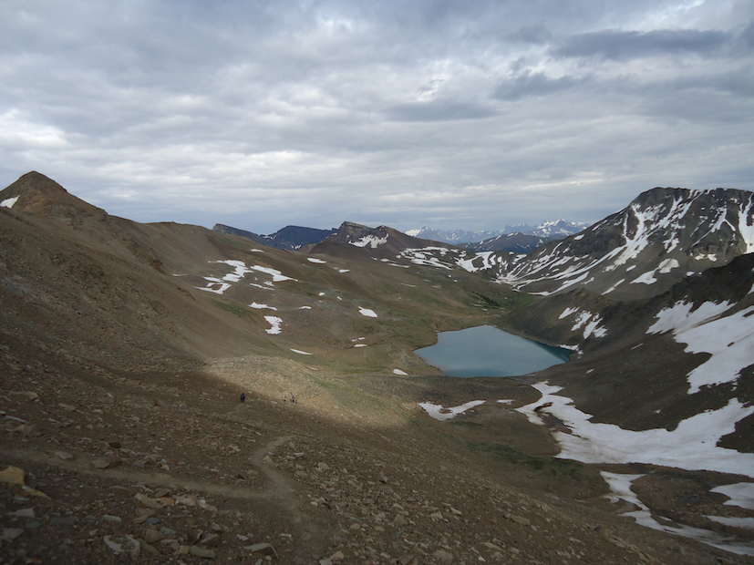
Campsite criteria: As we came through the Notch and looked out over Curator Lake, we were ready to quit for the day. We were tired and we had no idea how far we had to go before we could stop for the day. The pass on the horizon, just right of center in Figure 2, was part of tomorrow’s trek. Just above Curator lake, in Figure 2, is a green area. We made the correct assumption that somewhere in there we would find our campsite. The vast majority of the terrain was not suitable for any kind of temporary settlement. This green area off in the distance was the only place we could see that met campsite criteria:
- An easily accessible water source
- Protection from the elements
- Land suitable for setting up shelter (tents)

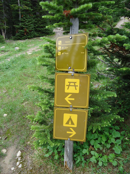
Campsite design: Here what we noticed about how each campsite was organized:
- A place to set up shelter
- A place to cook and store food
- A place for human waste (toilet)